Worked examples
28 maps, each one built from a real sheet
Every example shows the spreadsheet that produced it, the four choices behind it, and the map arriving one step at a time. Open the closest one to your data and change the numbers.
Planning and operations
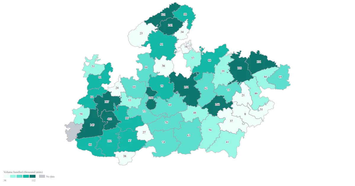
District-Wise Heat Map of India
Madhya Pradesh · District · Colour
One shaded map that puts the whole state on a single slide, so the pattern is settled in the first few seconds and the meeting can move on to what to do about it.
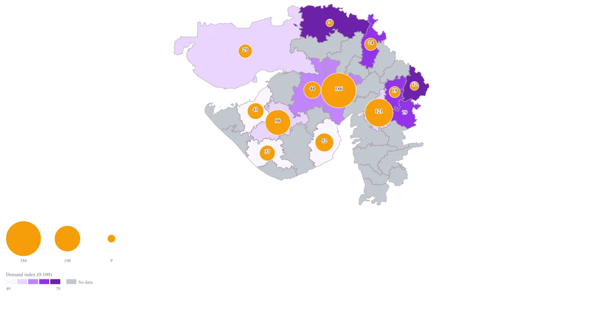
Coverage vs Demand Map of India
Gujarat · District · Bubble + colour
One map on which a small bubble sitting on a dark district is the finding: a place that needs a great deal and gets little from you. The districts you already serve well stop taking up the argument, because the map has already said so.
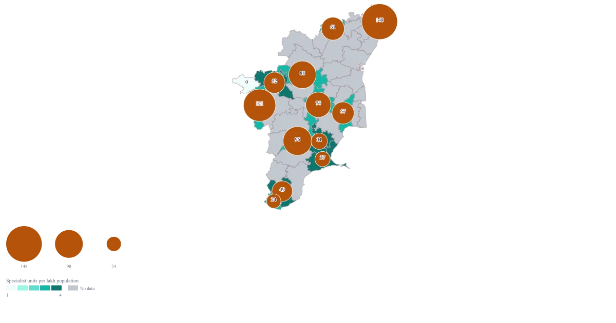
Health Facility Map of India by District
Tamil Nadu · District · Bubble + colour
One map on which the size of a circle is how many units a district has and the colour underneath is how many it has per lakh people, so the argument about which of those two you meant is settled before the meeting starts.
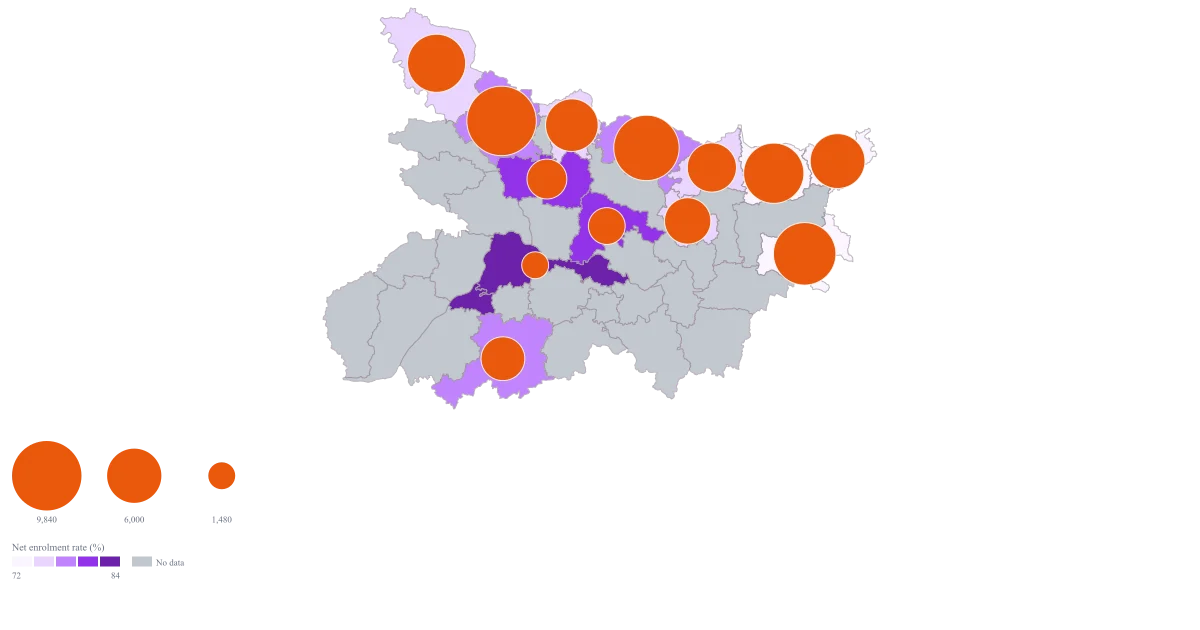
School Enrolment Map of India by District
Bihar · District · Bubble + colour
One map where the circle is how many children a district has to reach and the fill is how much of the age group is already in school, built from a sheet whose sum you can read back against your own return.
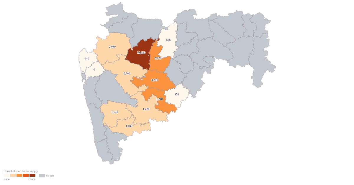
Water Scarcity Map of India by District
Maharashtra · District · Colour
One map on which the worst district is visibly the worst and the ordering among the remaining twelve is still readable, rather than a map that says only "Aurangabad" and stops.
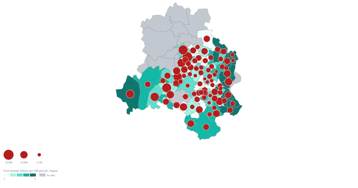
PIN Code Map of Delhi
Delhi · PIN Code · Bubble + colour
One Delhi map on which a large bubble sitting on a dark area is the argument won: a code carrying real volume that is also failing at the door. The codes that are merely busy stop taking up the meeting, because the fill has already said they are fine.
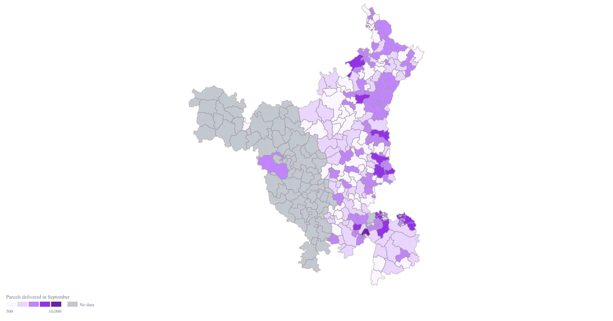
Delivery Volume Map by PIN Code
Haryana · PIN Code · Colour
A Haryana map shaded by parcels per PIN code, built from an export you have aggregated yourself, on buckets you chose, so the hub does not flatten the rest of the state into a single colour.
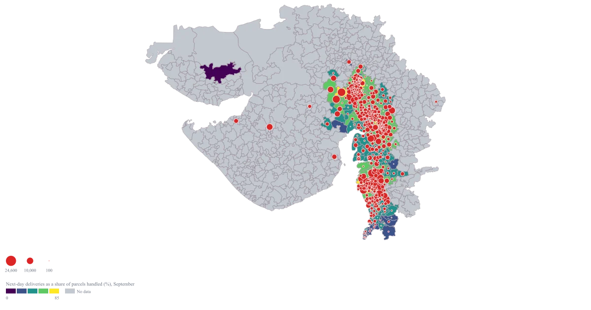
Warehouse Coverage Map by PIN Code
Gujarat · PIN Code · Bubble + colour
One Gujarat map on which a large bubble over a pale area is the case being made: real volume in a code the network is not reaching in time. The codes that are already fast stop being argued about, because the fill has settled them.
Research and reporting
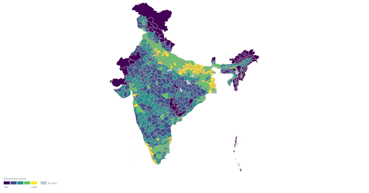
Population Density Map of India by District
Pan India · District · Colour
One shaded map of persons per square kilometre across India, with the ramp doing the reading and the arithmetic behind it still visible in the sheet beside it.
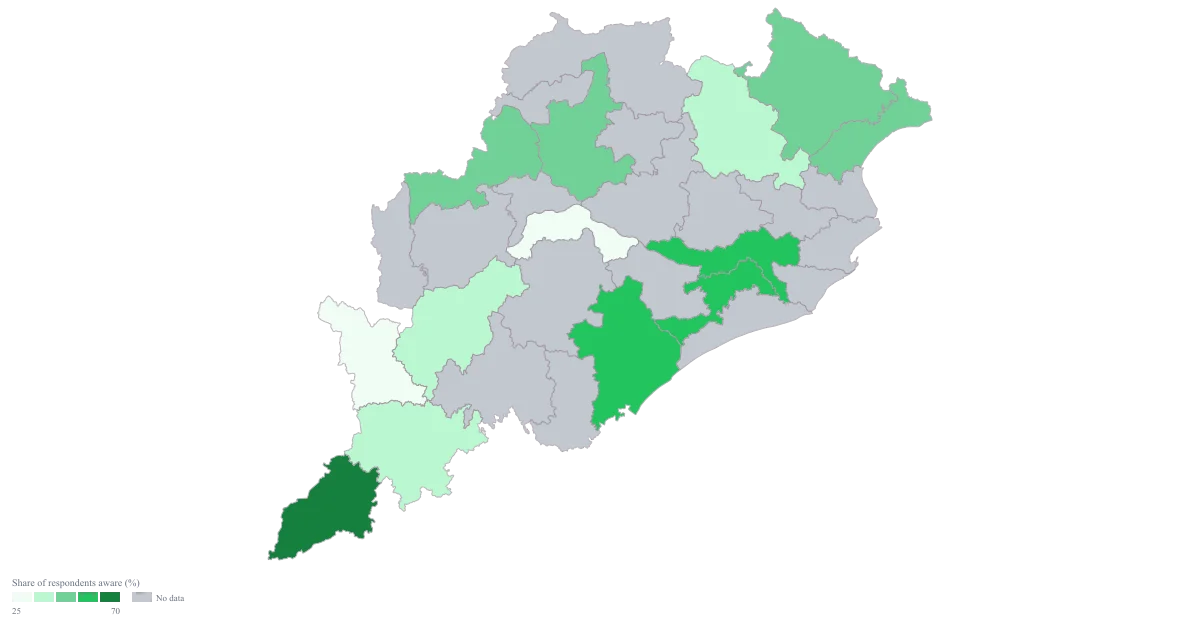
Survey Results Map of India
Odisha · District · Colour
A map that shows where the finding is strong and stays honest about where you barely asked, so a district resting on eleven interviews is not coloured with the confidence of one resting on nine hundred.
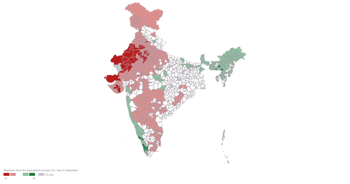
Rainfall Map of India by District
Pan India · District · Colour
One diverging map whose neutral band sits symmetrically around zero, so a reader can tell surplus from deficit from ordinary without consulting the numbers, and whose title states the months it covers.
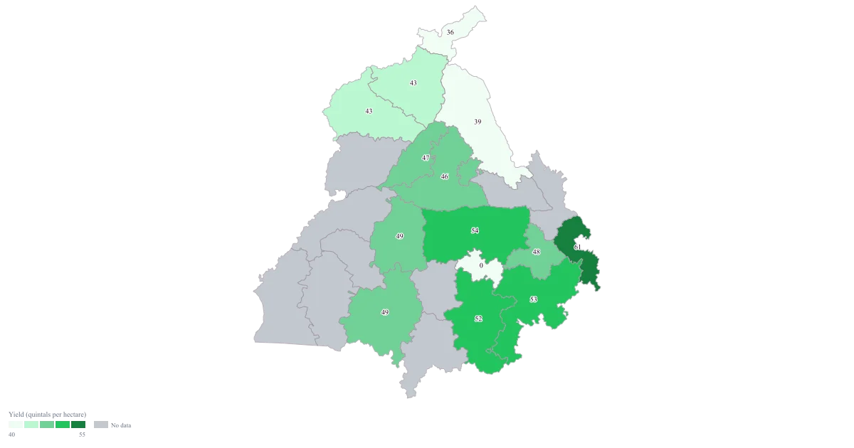
Crop Yield Map of India by District
Punjab · District · Colour
One shaded map of yield per hectare with the area it rests on still visible beside it, so the two districts a reader would otherwise confuse — the highly productive one and the merely efficient one — stay separate.
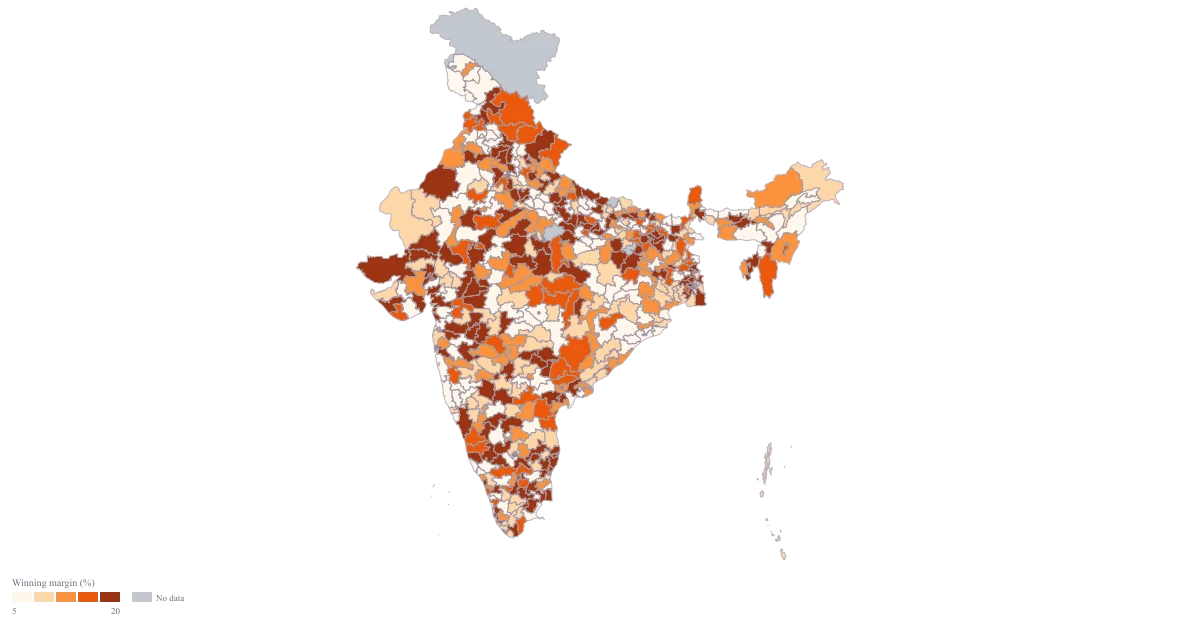
Election Results Map of India by Constituency
Pan India · Parliamentary · Colour
One national map shaded by the winning margin, with 540 of the 543 seats carrying a row, so the belt of close contests and the belt of walkovers are visible in the same glance, and the note can spend its words on why rather than on where.
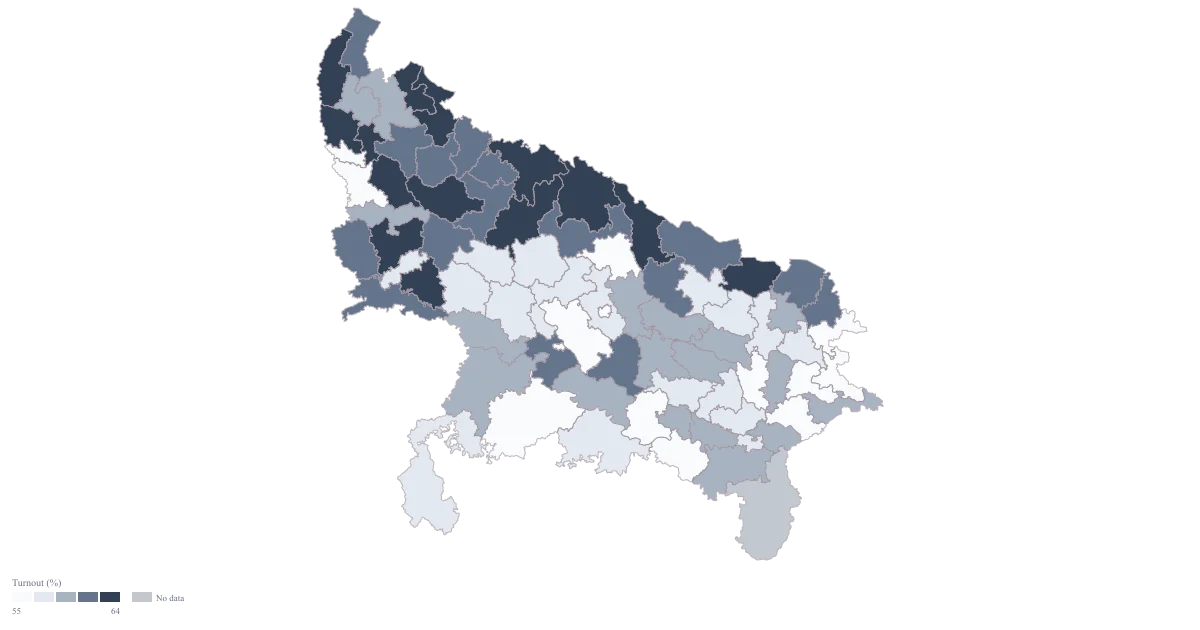
Voter Turnout Map of Uttar Pradesh by Constituency
Uttar Pradesh · Parliamentary · Colour
One map of all eighty of Uttar Pradesh's constituencies in which the eighteen-point spread between the busiest and the quietest seat is actually visible, and which still reads as a map after the plate has thrown away every colour you chose.
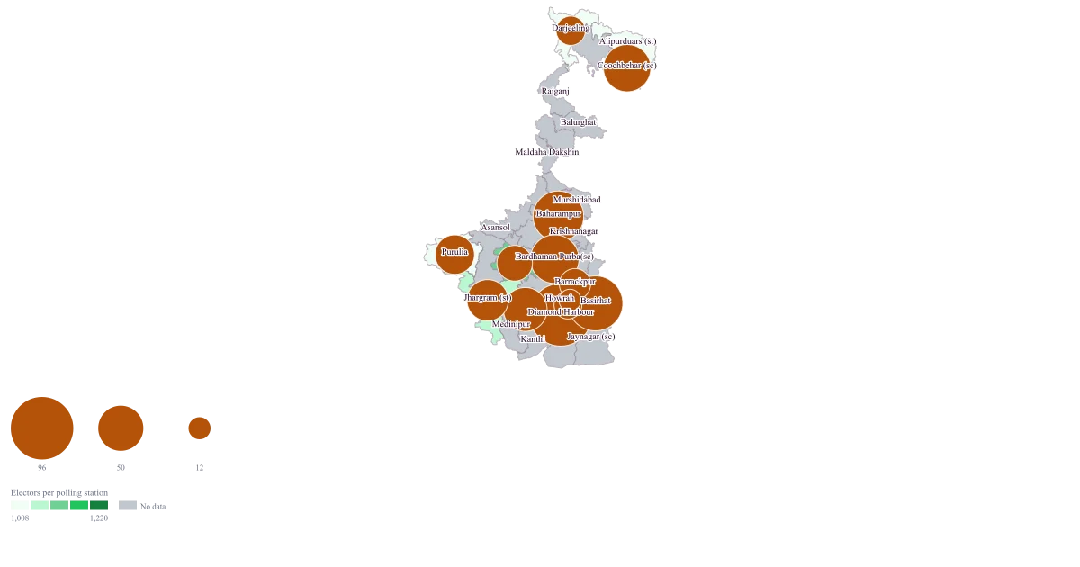
Parliamentary Constituency Map of West Bengal
West Bengal · Parliamentary · Bubble + colour
One map of West Bengal in which each seat carries how many polling stations were added at the last revision as a bubble and how crowded its stations already are as a fill — with every one of the 42 names resolving to the seat the geometry actually holds.
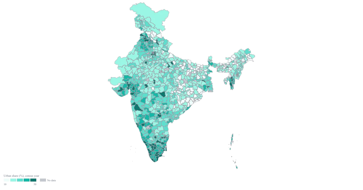
Census Data Map of India by District
Pan India · District · Colour
A Pan India district map of one census variable in which every blank is a blank you can explain, and a caption that states the vintage of the figures rather than letting the reader assume they are this year's.
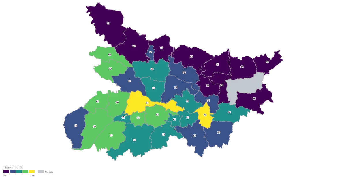
Literacy Rate Map of Bihar by District
Bihar · District · Colour
A district map of Bihar on which the size of the gaps is what the reader sees first, so the argument moves off which district is fourteenth and on to how far apart the top and the bottom of the state actually are.
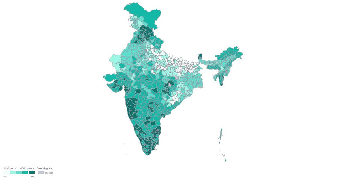
Employment Map of India by District
Pan India · District · Colour
A shaded map on fixed, stated bands, on which two districts take different colours only when the difference is one you are prepared to argue for, and on which the districts you could not source stay visibly unsourced instead of quietly joining the bottom band.
Commercial
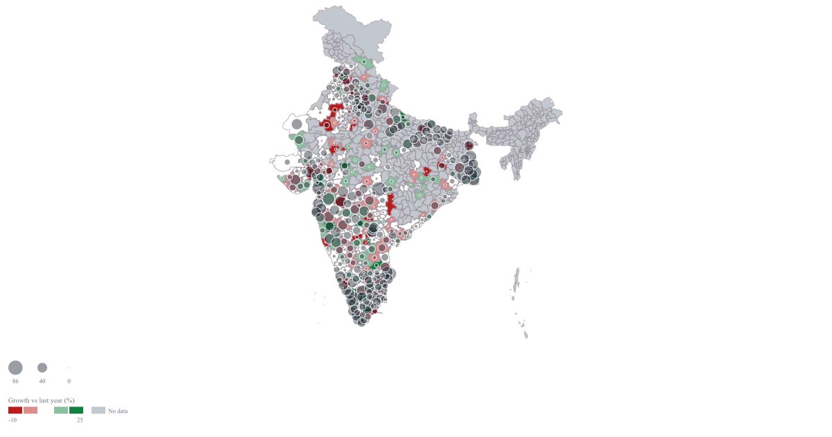
District-Wise Sales Heat Map of India
Pan India · District · Bubble + colour
One map that answers both questions at once: where the money is, and which of those places has stopped growing. You can point at a large pale bubble and say that this district is a quarter of the region and flat, which is a different conversation from a small bright one.
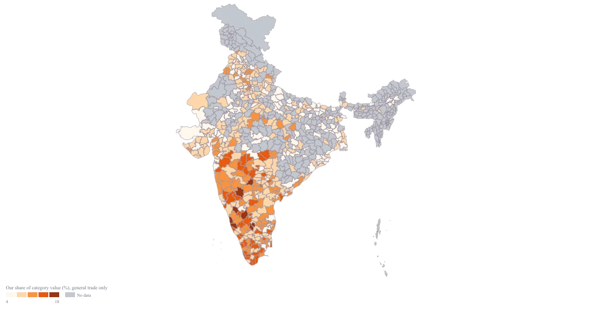
India Market Share Heat Map
Pan India · District · Colour
A single ramp that shows where you are strong relative to the category rather than absolutely — so a district contributing modest rupees but holding a fifth of its category stops looking like a weak market, and a large district you thought you owned turns out to be a large district you merely appear in.
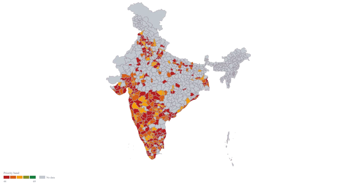
District Prioritisation Map for India
Pan India · District · Colour
A map with three colours, not a gradient: the districts that clear your investment bar, the ones worth a smaller test, and the ones that are explicitly not this year. Because the bands come from your own thresholds, the map can honestly show a year where only four districts qualify.
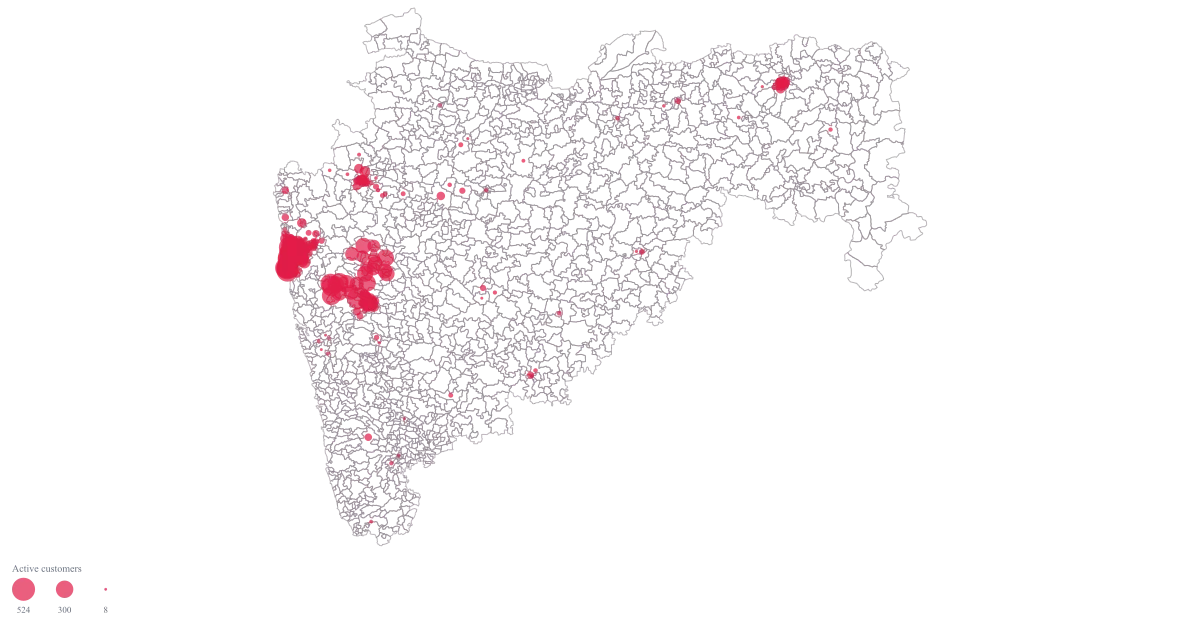
PIN Code Map of India for Customer Concentration
Maharashtra · PIN Code · Bubble
A Maharashtra map at PIN-code resolution where each area carries a bubble sized by its active customer count, so the dense pockets separate from the merely covered ones and you can name the codes you would switch on first.
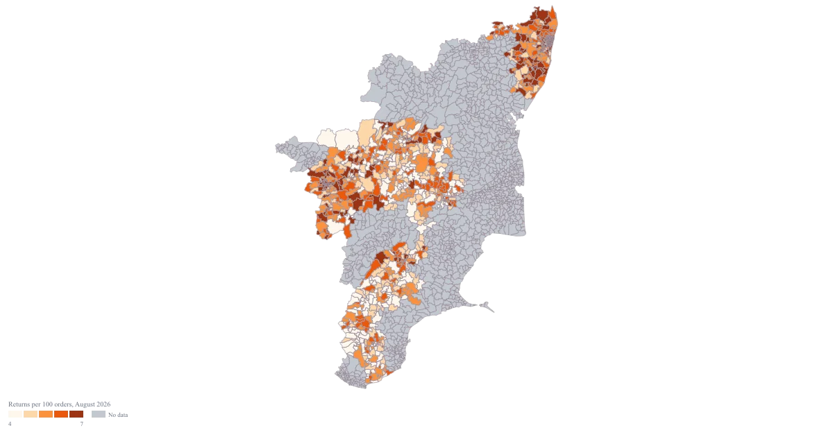
PIN Code Map of Tamil Nadu
Tamil Nadu · PIN Code · Colour
A Tamil Nadu map that puts the returns rate on the PIN areas it belongs to, with the period named on the legend and the second column deliberately kept off the map, so the exhibit says one thing and can be defended when it is challenged.
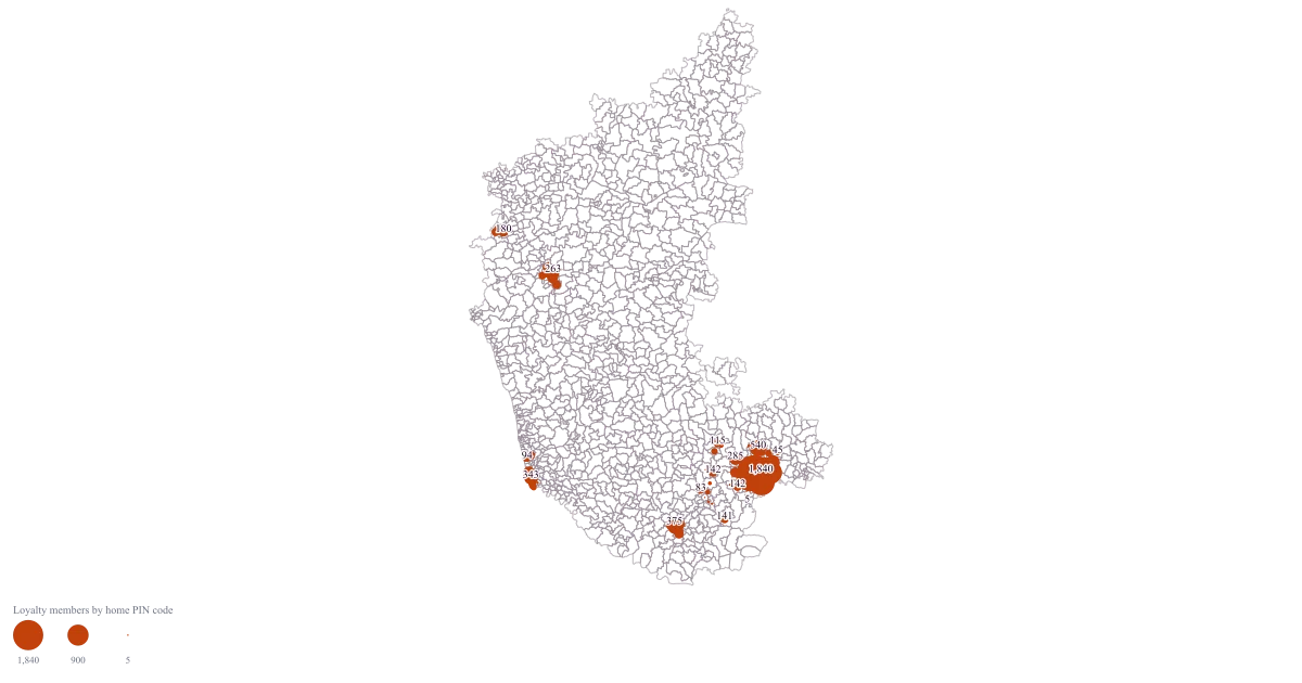
Store Catchment Map by PIN Code
Karnataka · PIN Code · Bubble
A Karnataka map with a bubble on every PIN code your members actually live in, sized by how many of them there are, so the shape of the existing draw is visible and the conversation moves from a drawn boundary to the codes you can name.
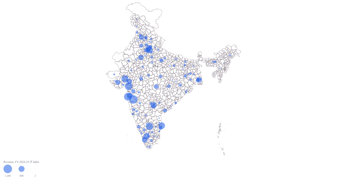
District-Wise Revenue Map of India
Pan India · District · Bubble
One map on which the size of a circle is the size of the business, so the handful of districts carrying most of the revenue announce themselves before anybody has read a row, and the argument moves on to what to do about the rest.
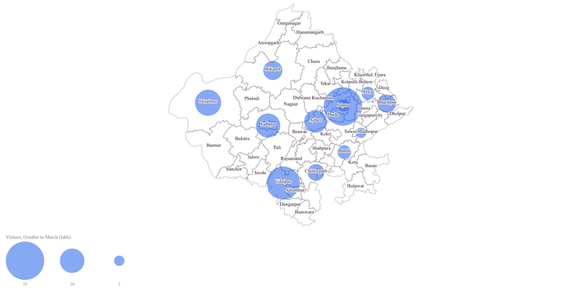
Tourism Footfall Map of Rajasthan by District
Rajasthan · District · Bubble
One Rajasthan map where the size of a circle is the size of the season's traffic, so the concentration is obvious in a glance and the conversation can start at why the second tier is the second tier rather than at which district is which.
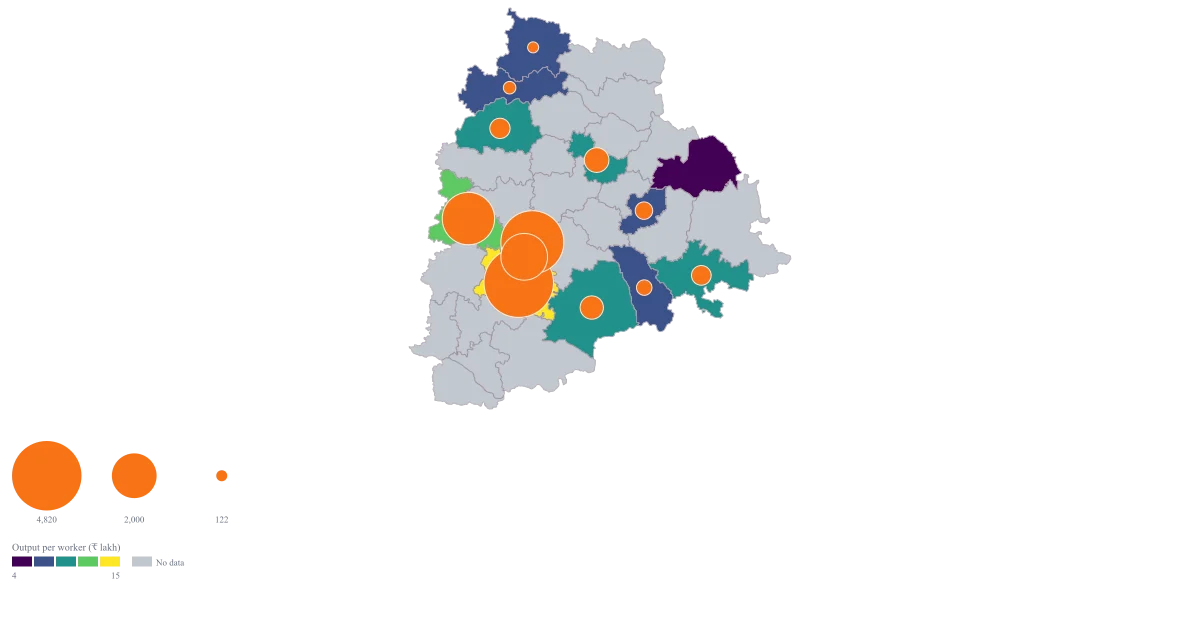
Manufacturing Output Map of Telangana by District
Telangana · District · Bubble + colour
One map that carries scale and intensity at once — a circle for how much a district makes, a fill for how much it makes per worker — so a small district that is dense per worker stops being invisible next to the districts around the capital.
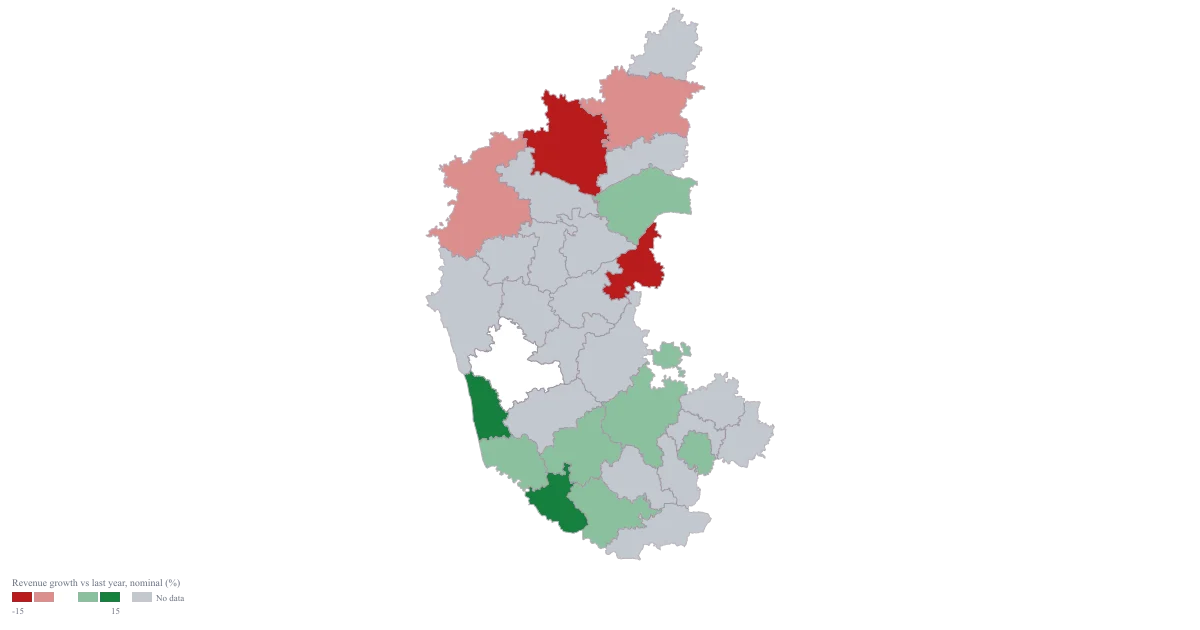
Growth Rate Map of Karnataka by District
Karnataka · District · Colour
A map with a real middle: districts that fell take one colour, districts that grew take another, and the flat district sits at the neutral centre where it belongs rather than being rounded into whichever end of the ramp it is nearest.