Worked example
PIN Code Map of India for Customer Concentration
You run growth at a direct-to-consumer brand and the orders export has a PIN code on every line. District-level maps are useless to you, because your entire Mumbai and Pune business collapses into four shapes, and the question on your desk is which specific PIN codes are dense enough to justify a same-day promise.
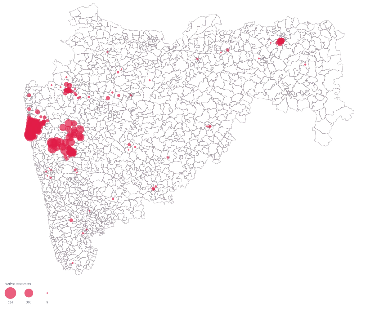
A Maharashtra map at PIN-code resolution where each area carries a bubble sized by its active customer count, so the dense pockets separate from the merely covered ones and you can name the codes you would switch on first.
The four choices behind it
How this map was made
Four questions, in the order the builder asks them. Every picture below is the real renderer on the real geography, so this is the sequence you will see on your own screen.
- Step 1
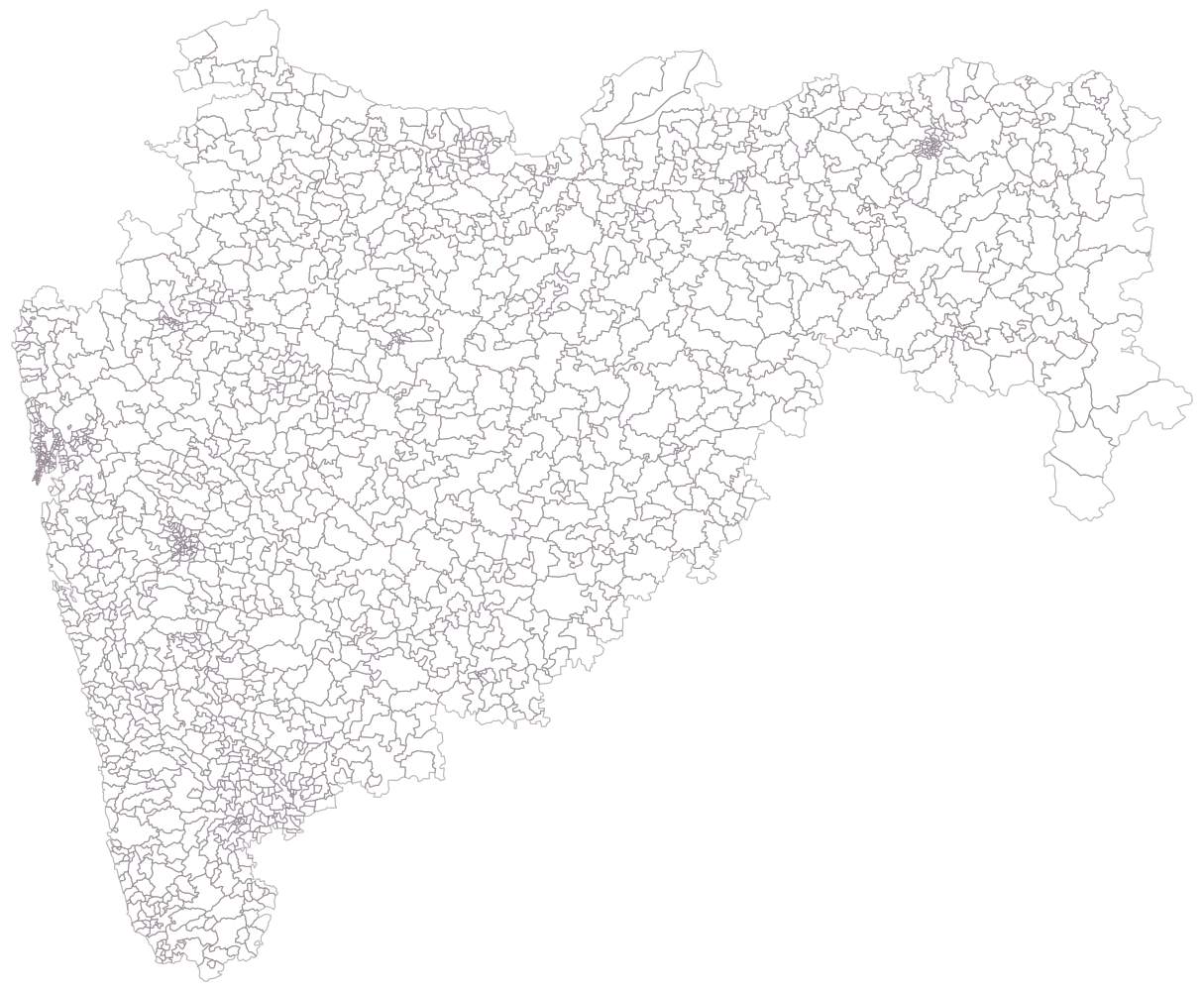
Choose Maharashtra at PIN-code level, because district shapes collapse your entire Mumbai and Pune business into four of them.
All 1,726 PIN areas are drawn empty, and the density of outlines around Mumbai, Thane and Pimpri-Chinchwad is itself the reason for this map: that is the detail a district map throws away.
- Step 2
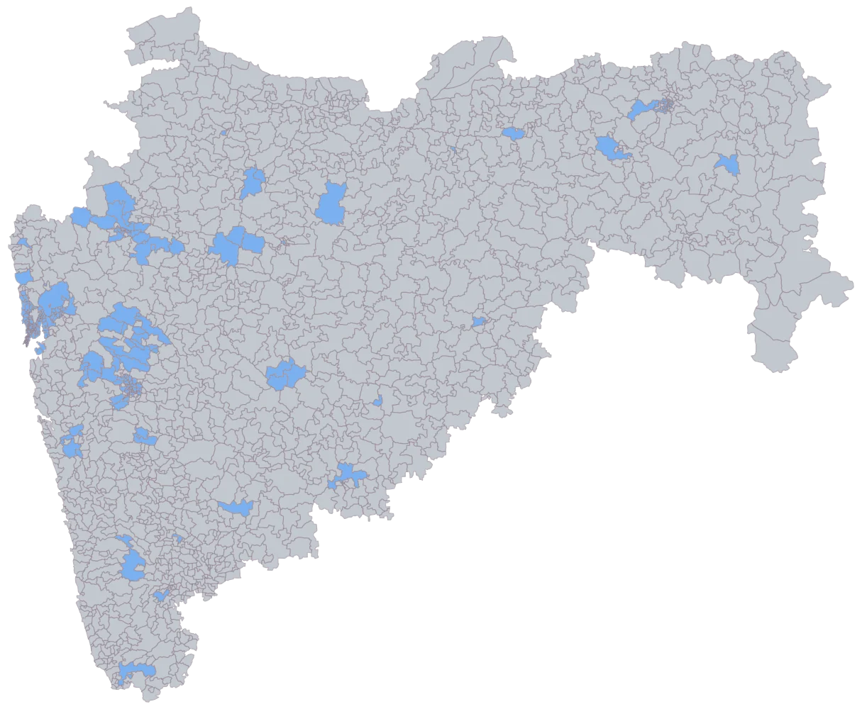
Paste the PIN column with active customers beside it.
284 cells shade flat blue and 1,442 stay empty, and the shaded ones already draw the shape of the business: Mumbai, Thane and Pune almost solid, Nashik and Nagpur smaller patches, and a scatter of single codes elsewhere. At this resolution that picture is also the whole join check, because an unmatched PIN is otherwise invisible: one unshaded cell among 1,726 looks exactly like every other unshaded cell.
- Step 3
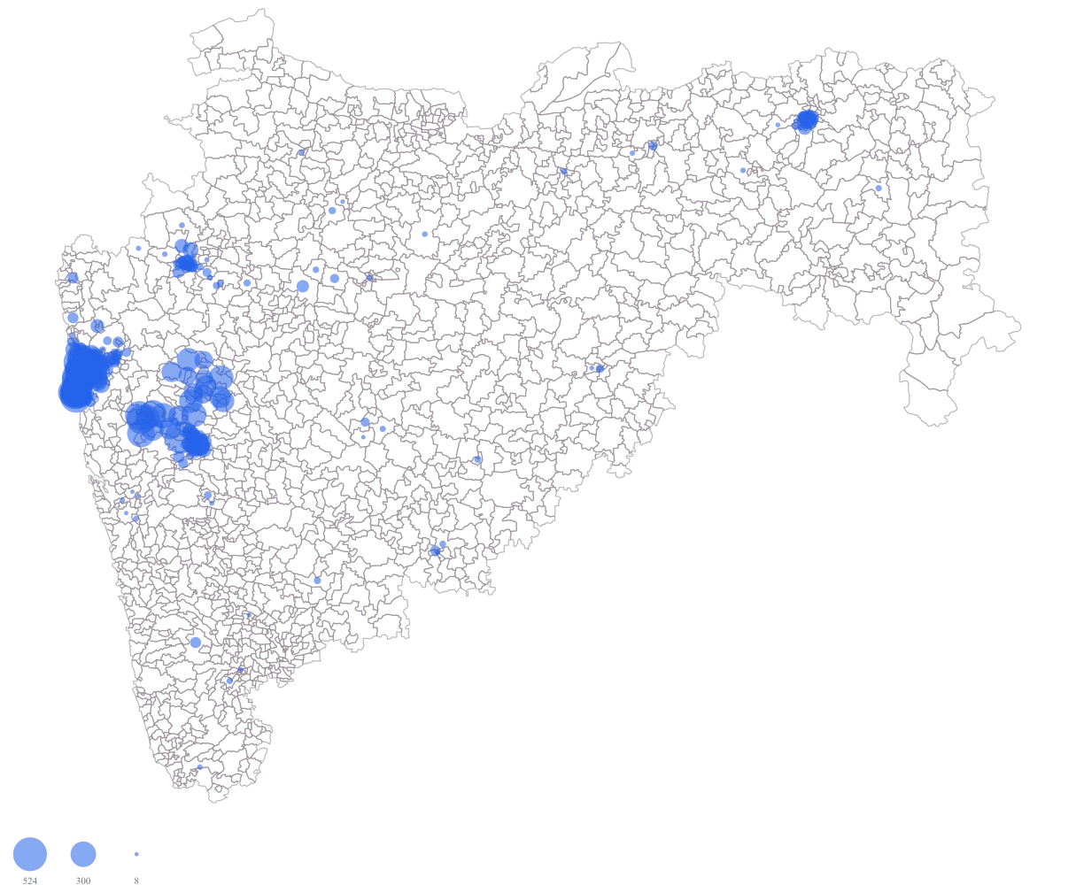
Send active customers to bubble size.
A circle appears at the centre of each PIN area, so 400101 at 524 and 411020 at 88 are compared on customer count rather than on how much ground the code covers. 411024 is a genuine 0 and draws no circle at all, which is why the serviceability check belongs in the sheet before this step.
- Step 4
Give the bubbles a slightly translucent crimson fill and title the legend Active customers.
Crimson lifts the circles off the pale cells beneath them, which the default blue does not manage where eighty-odd codes are stacked in a few square kilometres, and holding the fill just short of opaque keeps the stack readable: the Mumbai and Pimpri-Chinchwad codes darken where they overlap instead of fusing into one flat shape, while a lone code in Solapur or Amravati still reads at full strength. The titled legend also stops a reader taking the circles for orders, which is the other column on the sheet and roughly three times the size.
The sheet
Paste these columns straight from Excel. The first column names the place; the rest are numbers. Nothing is uploaded — your sheet is read in the browser.
| PIN code | Active customers | Orders last 90 days |
|---|---|---|
| 400101 | 524 | 1465 |
| 411057 | 478 | 1390 |
| 400054 | 412 | 1180 |
| 400050 | 386 | 1042 |
| 400102 | 297 | 812 |
| 400604 | 241 | 669 |
| 411001 | 203 | 548 |
| 400607 | 156 | 402 |
| 411006 | 134 | 361 |
| 440010 | 119 | 298 |
| 411020 | 88 | 214 |
| 411022 | 61 | 147 |
| 400610 | 38 | — |
| 411024 | 0 | 0 |
| 400001 | 339 | 958 |
| 400002 | 463 | 1230 |
The first 16 rows of 284. The map above is drawn from all of them — a national map wants a national sheet, and yours will be longer than this too.
Why this map
PIN-code areas differ enormously in physical size, so filling them lets one sprawling semi-rural code shout louder than the densest few square kilometres of Mumbai; a bubble per code keeps the comparison on the customer count where it belongs.
What goes wrong
A PIN code with no customers is not a PIN code with no demand. 411024 has a genuine zero here, and the reason may be that your courier does not service it, that your listing excluded it, or that nobody there wants the product — three findings with three different responses.
Join your courier’s serviceable PIN list to the sheet before you map, and drop the unserviceable codes out of the dataset rather than showing them as zeroes. What remains is a map of demand among codes you can actually reach, which is the only version that supports a same-day decision.
PIN-code polygons in the public source are approximate. Boundaries between adjacent codes are drawn to the best available interpretation, and neighbouring codes can appear merged or share an edge that does not match the postal reality on the ground, particularly on the fringes of Thane and Pimpri-Chinchwad.
Read this map as clusters rather than as boundaries. Treat a bright group of adjacent codes as one dense pocket and plan at that level; do not make a decision that turns on whether a specific street falls in 400604 or 400607, because the geometry is not precise enough to carry it.
A PIN code is a postal delivery unit, not a residential catchment, and the bubble sits at the centre of the area rather than on anybody’s address. An office-heavy code collects orders shipped to workplaces from people who live several codes away, which inflates it and deflates its residential neighbours.
Split the export by delivery type if you capture it, and map residential deliveries separately from office ones, so the concentration you read is the concentration you are planning for. Remember also that nothing here plots a point: there is no address, latitude or longitude on this map, so a warehouse or dark store cannot be shown on it, and the sensible use is choosing which codes to serve rather than siting the facility that serves them.
Other worked examples
- Store Catchment Map by PIN Code — Karnataka, pin code, bubble
- District-Wise Revenue Map of India — Pan India, district, bubble
- Tourism Footfall Map of Rajasthan by District — Rajasthan, district, bubble
- PIN Code Map of Delhi — Delhi, pin code, bubble + colour