District map
West Bengal district map
West Bengal has 23 districts in Maps by India Layer’s boundaries, each with its Local Government Directory (LGD) code. Colour them from your own spreadsheet and export a PNG or an editable SVG.
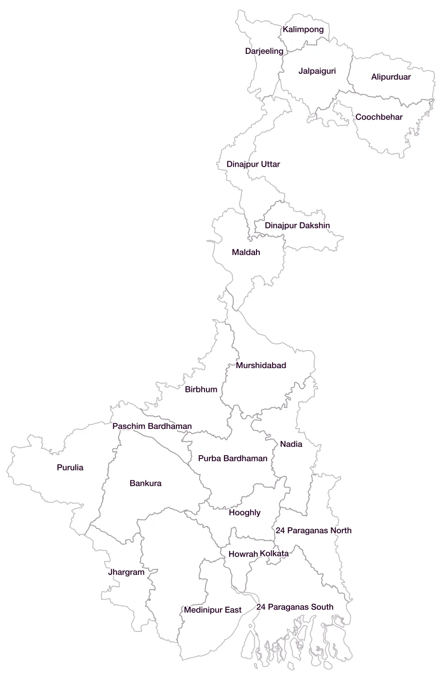
All 23 districts of West Bengal
- 24 Paraganas NorthLGD 303
- 24 Paraganas SouthLGD 304
- AlipurduarLGD 664
- BankuraLGD 305
- BirbhumLGD 307
- CoochbeharLGD 308
- DarjeelingLGD 309
- Dinajpur DakshinLGD 310
- Dinajpur UttarLGD 311
- HooghlyLGD 312
- HowrahLGD 313
- JalpaiguriLGD 314
- JhargramLGD 703
- KalimpongLGD 702
- KolkataLGD 315
- MaldahLGD 316
- Medinipur EastLGD 317
- Medinipur WestLGD 318
- MurshidabadLGD 319
- NadiaLGD 320
- Paschim BardhamanLGD 704
- Purba BardhamanLGD 306
- PuruliaLGD 321
Map data for West Bengal
Paste two columns from Excel, district name and value, and the builder matches each row to its district by name, including older spellings and former names. Your data stays in your browser.
West Bengal is also available by PIN code (1,217 areas) and Lok Sabha constituency (42 seats).
Boundaries: india-geodata (LGD, Survey of India, DataMeet), CC BY 4.0. District counts follow the boundary release in use (version 2026.09); a district created after that release is not yet on the map. This state page is part of the geography catalogue.
District maps of other states and UTs
- Andaman & Nicobar Islands
- Andhra Pradesh
- Arunachal Pradesh
- Assam
- Bihar
- Chandigarh
- Chhattisgarh
- Dadra & Nagar Haveli and Daman & Diu
- Delhi
- Goa
- Gujarat
- Haryana
- Himachal Pradesh
- Jammu & Kashmir
- Jharkhand
- Karnataka
- Kerala
- Ladakh
- Lakshadweep
- Madhya Pradesh
- Maharashtra
- Manipur
- Meghalaya
- Mizoram
- Nagaland
- Odisha
- Puducherry
- Punjab
- Rajasthan
- Sikkim
- Tamil Nadu
- Telangana
- Tripura
- Uttar Pradesh
- Uttarakhand