District map
Andhra Pradesh district map
Andhra Pradesh has 26 districts in Maps by India Layer’s boundaries, each with its Local Government Directory (LGD) code. Colour them from your own spreadsheet and export a PNG or an editable SVG.
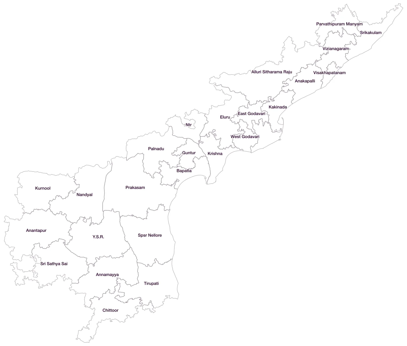
All 26 districts of Andhra Pradesh
- Alluri Sitharama RajuLGD 745
- AnakapalliLGD 744
- AnantapurLGD 502
- AnnamayyaLGD 753
- BapatlaLGD 750
- ChittoorLGD 503
- East GodavariLGD 505
- EluruLGD 748
- GunturLGD 506
- KakinadaLGD 746
- KonaseemaLGD 747
- KrishnaLGD 510
- KurnoolLGD 511
- NandyalLGD 755
- NtrLGD 749
- PalnaduLGD 751
- Parvathipuram ManyamLGD 743
- PrakasamLGD 517
- Spsr NelloreLGD 515
- Sri Sathya SaiLGD 754
- SrikakulamLGD 519
- TirupatiLGD 752
- VisakhapatanamLGD 520
- VizianagaramLGD 521
- West GodavariLGD 523
- Y.S.R.LGD 504
Map data for Andhra Pradesh
Paste two columns from Excel, district name and value, and the builder matches each row to its district by name, including older spellings and former names. Your data stays in your browser.
Andhra Pradesh is also available by PIN code (1,207 areas) and Lok Sabha constituency (25 seats).
Boundaries: india-geodata (LGD, Survey of India, DataMeet), CC BY 4.0. District counts follow the boundary release in use (version 2026.09); a district created after that release is not yet on the map. This state page is part of the geography catalogue.
District maps of other states and UTs
- Andaman & Nicobar Islands
- Arunachal Pradesh
- Assam
- Bihar
- Chandigarh
- Chhattisgarh
- Dadra & Nagar Haveli and Daman & Diu
- Delhi
- Goa
- Gujarat
- Haryana
- Himachal Pradesh
- Jammu & Kashmir
- Jharkhand
- Karnataka
- Kerala
- Ladakh
- Lakshadweep
- Madhya Pradesh
- Maharashtra
- Manipur
- Meghalaya
- Mizoram
- Nagaland
- Odisha
- Puducherry
- Punjab
- Rajasthan
- Sikkim
- Tamil Nadu
- Telangana
- Tripura
- Uttar Pradesh
- Uttarakhand
- West Bengal