District map
Tamil Nadu district map
Tamil Nadu has 38 districts in Maps by India Layer’s boundaries, each with its Local Government Directory (LGD) code. Colour them from your own spreadsheet and export a PNG or an editable SVG.
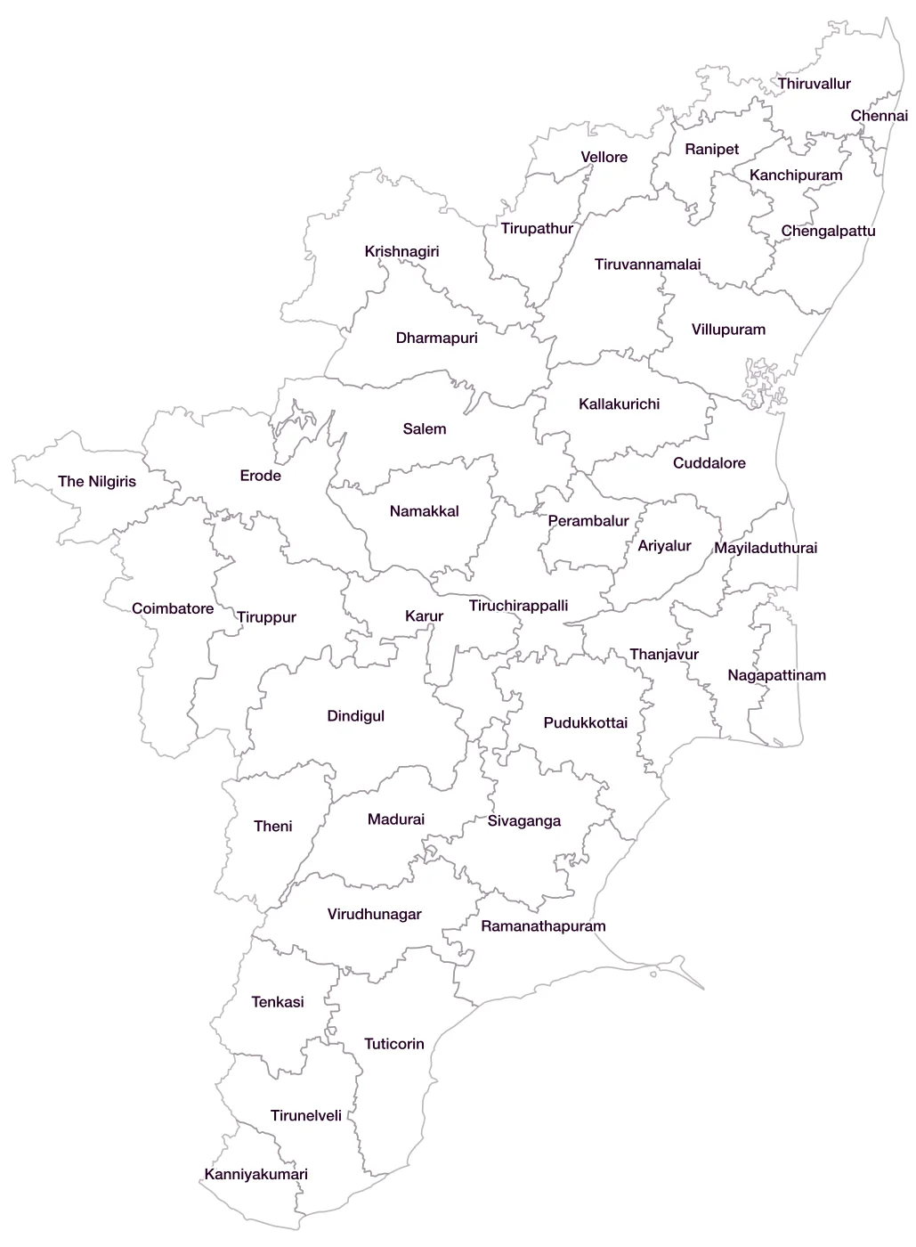
All 38 districts of Tamil Nadu
- AriyalurLGD 610
- ChengalpattuLGD 730
- ChennaiLGD 568
- CoimbatoreLGD 569
- CuddaloreLGD 570
- DharmapuriLGD 571
- DindigulLGD 572
- ErodeLGD 573
- KallakurichiLGD 729
- KanchipuramLGD 574
- KanniyakumariLGD 575
- KarurLGD 576
- KrishnagiriLGD 577
- MaduraiLGD 578
- MayiladuthuraiLGD 735
- NagapattinamLGD 579
- NamakkalLGD 580
- PerambalurLGD 581
- PudukkottaiLGD 582
- RamanathapuramLGD 583
- RanipetLGD 731
- SalemLGD 584
- SivagangaLGD 585
- TenkasiLGD 733
- ThanjavurLGD 586
- The NilgirisLGD 587
- TheniLGD 588
- ThiruvallurLGD 589
- ThiruvarurLGD 590
- TiruchirappalliLGD 591
- TirunelveliLGD 592
- TirupathurLGD 732
- TiruppurLGD 634
- TiruvannamalaiLGD 593
- TuticorinLGD 594
- VelloreLGD 595
- VillupuramLGD 596
- VirudhunagarLGD 597
Map data for Tamil Nadu
Paste two columns from Excel, district name and value, and the builder matches each row to its district by name, including older spellings and former names. Your data stays in your browser.
Tamil Nadu is also available by PIN code (2,038 areas) and Lok Sabha constituency (39 seats).
Boundaries: india-geodata (LGD, Survey of India, DataMeet), CC BY 4.0. District counts follow the boundary release in use (version 2026.09); a district created after that release is not yet on the map. This state page is part of the geography catalogue.
District maps of other states and UTs
- Andaman & Nicobar Islands
- Andhra Pradesh
- Arunachal Pradesh
- Assam
- Bihar
- Chandigarh
- Chhattisgarh
- Dadra & Nagar Haveli and Daman & Diu
- Delhi
- Goa
- Gujarat
- Haryana
- Himachal Pradesh
- Jammu & Kashmir
- Jharkhand
- Karnataka
- Kerala
- Ladakh
- Lakshadweep
- Madhya Pradesh
- Maharashtra
- Manipur
- Meghalaya
- Mizoram
- Nagaland
- Odisha
- Puducherry
- Punjab
- Rajasthan
- Sikkim
- Telangana
- Tripura
- Uttar Pradesh
- Uttarakhand
- West Bengal