District map
Madhya Pradesh district map
Madhya Pradesh has 52 districts in Maps by India Layer’s boundaries, each with its Local Government Directory (LGD) code. Colour them from your own spreadsheet and export a PNG or an editable SVG.
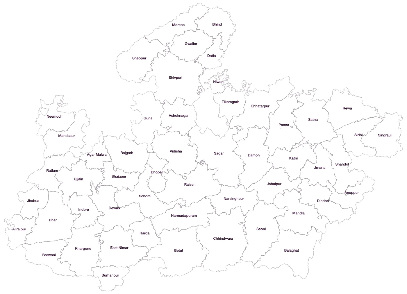
All 52 districts of Madhya Pradesh
- Agar MalwaLGD 667
- AlirajpurLGD 639
- AnuppurLGD 390
- AshoknagarLGD 391
- BalaghatLGD 392
- BarwaniLGD 393
- BetulLGD 394
- BhindLGD 395
- BhopalLGD 396
- BurhanpurLGD 397
- ChhatarpurLGD 398
- ChhindwaraLGD 399
- DamohLGD 400
- DatiaLGD 401
- DewasLGD 402
- DharLGD 403
- DindoriLGD 404
- East NimarLGD 405
- GunaLGD 406
- GwaliorLGD 407
- HardaLGD 408
- IndoreLGD 410
- JabalpurLGD 411
- JhabuaLGD 412
- KatniLGD 413
- KhargoneLGD 414
- MandlaLGD 415
- MandsaurLGD 416
- MorenaLGD 417
- NarmadapuramLGD 409
- NarsinghpurLGD 418
- NeemuchLGD 419
- NiwariLGD 722
- PannaLGD 420
- RaisenLGD 421
- RajgarhLGD 422
- RatlamLGD 423
- RewaLGD 424
- SagarLGD 425
- SatnaLGD 426
- SehoreLGD 427
- SeoniLGD 428
- ShahdolLGD 429
- ShajapurLGD 430
- SheopurLGD 431
- ShivpuriLGD 432
- SidhiLGD 433
- SingrauliLGD 638
- TikamgarhLGD 434
- UjjainLGD 435
- UmariaLGD 436
- VidishaLGD 437
Map data for Madhya Pradesh
Paste two columns from Excel, district name and value, and the builder matches each row to its district by name, including older spellings and former names. Your data stays in your browser.
Madhya Pradesh is also available by PIN code (891 areas) and Lok Sabha constituency (29 seats).
Boundaries: india-geodata (LGD, Survey of India, DataMeet), CC BY 4.0. District counts follow the boundary release in use (version 2026.09); a district created after that release is not yet on the map. This state page is part of the geography catalogue.
District maps of other states and UTs
- Andaman & Nicobar Islands
- Andhra Pradesh
- Arunachal Pradesh
- Assam
- Bihar
- Chandigarh
- Chhattisgarh
- Dadra & Nagar Haveli and Daman & Diu
- Delhi
- Goa
- Gujarat
- Haryana
- Himachal Pradesh
- Jammu & Kashmir
- Jharkhand
- Karnataka
- Kerala
- Ladakh
- Lakshadweep
- Maharashtra
- Manipur
- Meghalaya
- Mizoram
- Nagaland
- Odisha
- Puducherry
- Punjab
- Rajasthan
- Sikkim
- Tamil Nadu
- Telangana
- Tripura
- Uttar Pradesh
- Uttarakhand
- West Bengal