District map
Odisha district map
Odisha has 30 districts in Maps by India Layer’s boundaries, each with its Local Government Directory (LGD) code. Colour them from your own spreadsheet and export a PNG or an editable SVG.
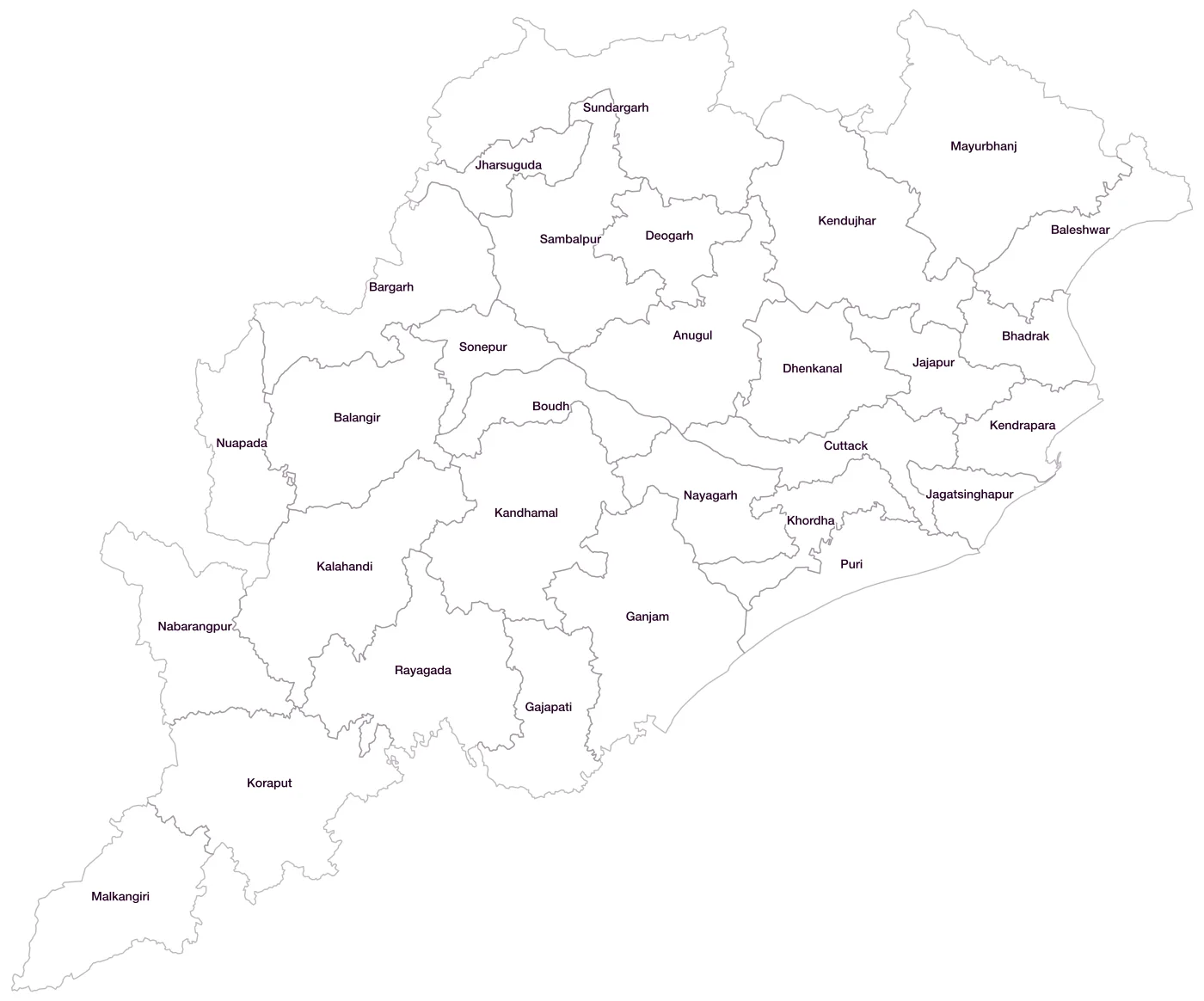
All 30 districts of Odisha
- AnugulLGD 344
- BalangirLGD 345
- BaleshwarLGD 346
- BargarhLGD 347
- BhadrakLGD 348
- BoudhLGD 349
- CuttackLGD 350
- DeogarhLGD 351
- DhenkanalLGD 352
- GajapatiLGD 353
- GanjamLGD 354
- JagatsinghapurLGD 355
- JajapurLGD 356
- JharsugudaLGD 357
- KalahandiLGD 358
- KandhamalLGD 359
- KendraparaLGD 360
- KendujharLGD 361
- KhordhaLGD 362
- KoraputLGD 363
- MalkangiriLGD 364
- MayurbhanjLGD 365
- NabarangpurLGD 366
- NayagarhLGD 367
- NuapadaLGD 368
- PuriLGD 369
- RayagadaLGD 370
- SambalpurLGD 371
- SonepurLGD 372
- SundargarhLGD 373
Map data for Odisha
Paste two columns from Excel, district name and value, and the builder matches each row to its district by name, including older spellings and former names. Your data stays in your browser.
Odisha is also available by PIN code (1,017 areas) and Lok Sabha constituency (21 seats).
Boundaries: india-geodata (LGD, Survey of India, DataMeet), CC BY 4.0. District counts follow the boundary release in use (version 2026.09); a district created after that release is not yet on the map. This state page is part of the geography catalogue.
District maps of other states and UTs
- Andaman & Nicobar Islands
- Andhra Pradesh
- Arunachal Pradesh
- Assam
- Bihar
- Chandigarh
- Chhattisgarh
- Dadra & Nagar Haveli and Daman & Diu
- Delhi
- Goa
- Gujarat
- Haryana
- Himachal Pradesh
- Jammu & Kashmir
- Jharkhand
- Karnataka
- Kerala
- Ladakh
- Lakshadweep
- Madhya Pradesh
- Maharashtra
- Manipur
- Meghalaya
- Mizoram
- Nagaland
- Puducherry
- Punjab
- Rajasthan
- Sikkim
- Tamil Nadu
- Telangana
- Tripura
- Uttar Pradesh
- Uttarakhand
- West Bengal