District map
Rajasthan district map
Rajasthan has 50 districts in Maps by India Layer’s boundaries, each with its Local Government Directory (LGD) code. Colour them from your own spreadsheet and export a PNG or an editable SVG.
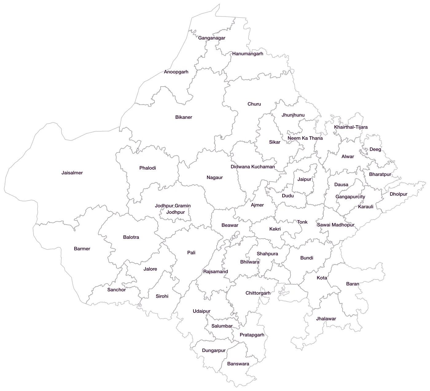
All 50 districts of Rajasthan
- AjmerLGD 86
- AlwarLGD 87
- AnoopgarhLGD 776
- BalotraLGD 775
- BanswaraLGD 88
- BaranLGD 89
- BarmerLGD 90
- BeawarLGD 774
- BharatpurLGD 91
- BhilwaraLGD 92
- BikanerLGD 93
- BundiLGD 94
- ChittorgarhLGD 95
- ChuruLGD 96
- DausaLGD 97
- DeegLGD 767
- DholpurLGD 98
- Didwana KuchamanLGD 768
- DuduLGD 769
- DungarpurLGD 99
- GanganagarLGD 100
- GangapurcityLGD 771
- HanumangarhLGD 101
- JaipurLGD 102
- Jaipur GraminLGD 783
- JaisalmerLGD 103
- JaloreLGD 104
- JhalawarLGD 105
- JhunjhunuLGD 106
- JodhpurLGD 107
- Jodhpur GraminLGD 778
- KarauliLGD 108
- KekriLGD 781
- Khairthal-TijaraLGD 770
- KotaLGD 109
- Kotputli-BehrorLGD 782
- NagaurLGD 110
- Neem Ka ThanaLGD 773
- PaliLGD 111
- PhalodiLGD 772
- PratapgarhLGD 629
- RajsamandLGD 112
- SalumbarLGD 777
- SanchorLGD 779
- Sawai MadhopurLGD 113
- ShahpuraLGD 780
- SikarLGD 114
- SirohiLGD 115
- TonkLGD 116
- UdaipurLGD 117
Map data for Rajasthan
Paste two columns from Excel, district name and value, and the builder matches each row to its district by name, including older spellings and former names. Your data stays in your browser.
Rajasthan is also available by PIN code (1,040 areas) and Lok Sabha constituency (25 seats).
Boundaries: india-geodata (LGD, Survey of India, DataMeet), CC BY 4.0. District counts follow the boundary release in use (version 2026.09); a district created after that release is not yet on the map. This state page is part of the geography catalogue.
District maps of other states and UTs
- Andaman & Nicobar Islands
- Andhra Pradesh
- Arunachal Pradesh
- Assam
- Bihar
- Chandigarh
- Chhattisgarh
- Dadra & Nagar Haveli and Daman & Diu
- Delhi
- Goa
- Gujarat
- Haryana
- Himachal Pradesh
- Jammu & Kashmir
- Jharkhand
- Karnataka
- Kerala
- Ladakh
- Lakshadweep
- Madhya Pradesh
- Maharashtra
- Manipur
- Meghalaya
- Mizoram
- Nagaland
- Odisha
- Puducherry
- Punjab
- Sikkim
- Tamil Nadu
- Telangana
- Tripura
- Uttar Pradesh
- Uttarakhand
- West Bengal