District map
Maharashtra district map
Maharashtra has 36 districts in Maps by India Layer’s boundaries, each with its Local Government Directory (LGD) code. Colour them from your own spreadsheet and export a PNG or an editable SVG.
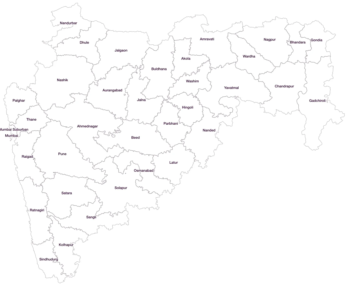
All 36 districts of Maharashtra
- AhmednagarLGD 466
- AkolaLGD 467
- AmravatiLGD 468
- AurangabadLGD 469
- BeedLGD 470
- BhandaraLGD 471
- BuldhanaLGD 472
- ChandrapurLGD 473
- DhuleLGD 474
- GadchiroliLGD 475
- GondiaLGD 476
- HingoliLGD 477
- JalgaonLGD 478
- JalnaLGD 479
- KolhapurLGD 480
- LaturLGD 481
- MumbaiLGD 482
- Mumbai SuburbanLGD 483
- NagpurLGD 484
- NandedLGD 485
- NandurbarLGD 486
- NashikLGD 487
- OsmanabadLGD 488
- PalgharLGD 665
- ParbhaniLGD 489
- PuneLGD 490
- RaigadLGD 491
- RatnagiriLGD 492
- SangliLGD 493
- SataraLGD 494
- SindhudurgLGD 495
- SolapurLGD 496
- ThaneLGD 497
- WardhaLGD 498
- WashimLGD 499
- YavatmalLGD 500
Map data for Maharashtra
Paste two columns from Excel, district name and value, and the builder matches each row to its district by name, including older spellings and former names. Your data stays in your browser.
Maharashtra is also available by PIN code (1,726 areas) and Lok Sabha constituency (48 seats).
Boundaries: india-geodata (LGD, Survey of India, DataMeet), CC BY 4.0. District counts follow the boundary release in use (version 2026.09); a district created after that release is not yet on the map. This state page is part of the geography catalogue.
District maps of other states and UTs
- Andaman & Nicobar Islands
- Andhra Pradesh
- Arunachal Pradesh
- Assam
- Bihar
- Chandigarh
- Chhattisgarh
- Dadra & Nagar Haveli and Daman & Diu
- Delhi
- Goa
- Gujarat
- Haryana
- Himachal Pradesh
- Jammu & Kashmir
- Jharkhand
- Karnataka
- Kerala
- Ladakh
- Lakshadweep
- Madhya Pradesh
- Manipur
- Meghalaya
- Mizoram
- Nagaland
- Odisha
- Puducherry
- Punjab
- Rajasthan
- Sikkim
- Tamil Nadu
- Telangana
- Tripura
- Uttar Pradesh
- Uttarakhand
- West Bengal