District map
Telangana district map
Telangana has 33 districts in Maps by India Layer’s boundaries, each with its Local Government Directory (LGD) code. Colour them from your own spreadsheet and export a PNG or an editable SVG.
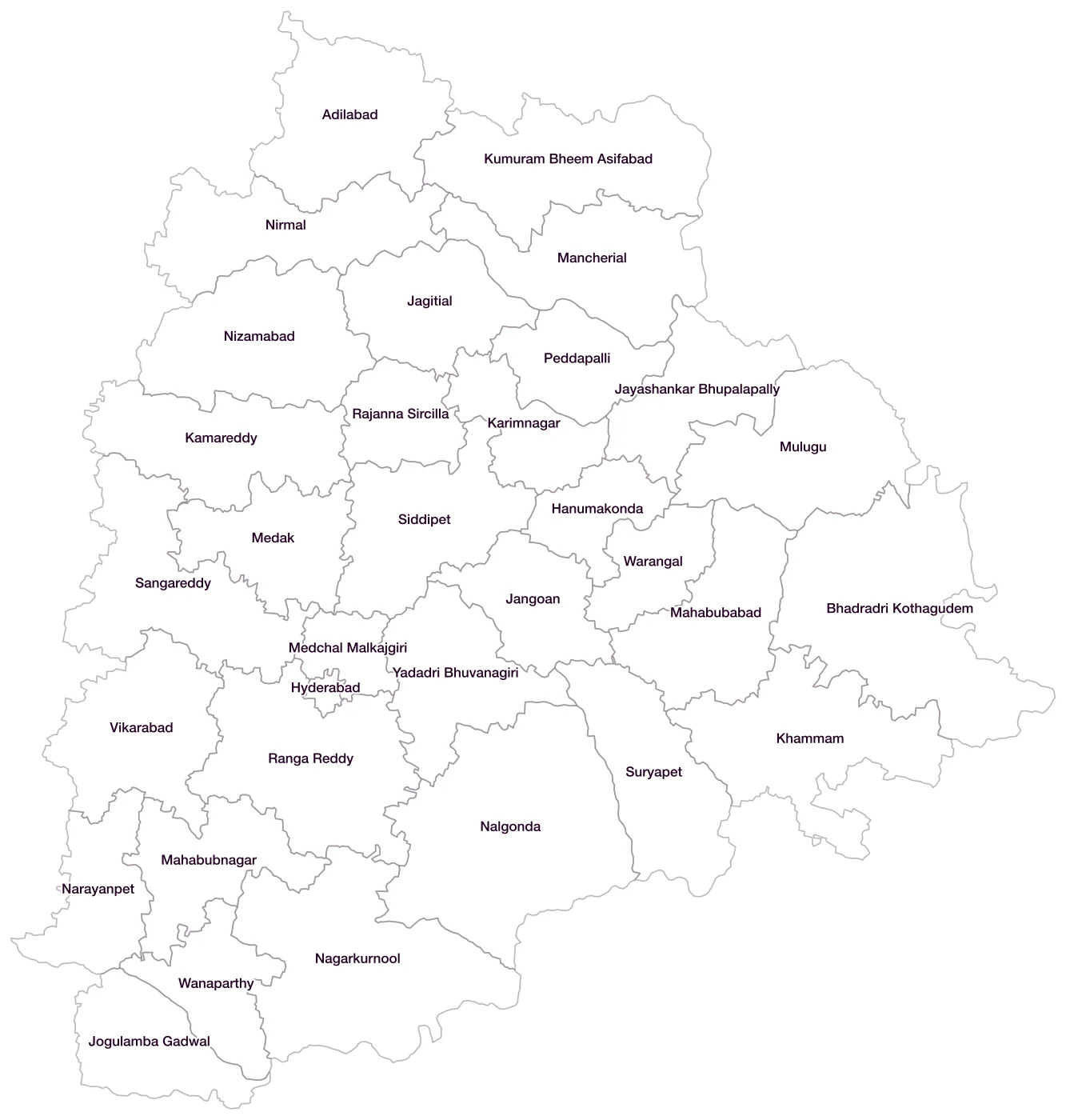
All 33 districts of Telangana
- AdilabadLGD 501
- Bhadradri KothagudemLGD 690
- HanumakondaLGD 686
- HyderabadLGD 507
- JagitialLGD 681
- JangoanLGD 689
- Jayashankar BhupalapallyLGD 687
- Jogulamba GadwalLGD 695
- KamareddyLGD 685
- KarimnagarLGD 508
- KhammamLGD 509
- Kumuram Bheem AsifabadLGD 699
- MahabubabadLGD 688
- MahabubnagarLGD 512
- MancherialLGD 684
- MedakLGD 513
- Medchal MalkajgiriLGD 700
- MuluguLGD 720
- NagarkurnoolLGD 694
- NalgondaLGD 514
- NarayanpetLGD 721
- NirmalLGD 680
- NizamabadLGD 516
- PeddapalliLGD 682
- Rajanna SircillaLGD 683
- Ranga ReddyLGD 518
- SangareddyLGD 691
- SiddipetLGD 692
- SuryapetLGD 696
- VikarabadLGD 698
- WanaparthyLGD 693
- WarangalLGD 522
- Yadadri BhuvanagiriLGD 697
Map data for Telangana
Paste two columns from Excel, district name and value, and the builder matches each row to its district by name, including older spellings and former names. Your data stays in your browser.
Telangana is also available by PIN code (675 areas) and Lok Sabha constituency (17 seats).
Boundaries: india-geodata (LGD, Survey of India, DataMeet), CC BY 4.0. District counts follow the boundary release in use (version 2026.09); a district created after that release is not yet on the map. This state page is part of the geography catalogue.
District maps of other states and UTs
- Andaman & Nicobar Islands
- Andhra Pradesh
- Arunachal Pradesh
- Assam
- Bihar
- Chandigarh
- Chhattisgarh
- Dadra & Nagar Haveli and Daman & Diu
- Delhi
- Goa
- Gujarat
- Haryana
- Himachal Pradesh
- Jammu & Kashmir
- Jharkhand
- Karnataka
- Kerala
- Ladakh
- Lakshadweep
- Madhya Pradesh
- Maharashtra
- Manipur
- Meghalaya
- Mizoram
- Nagaland
- Odisha
- Puducherry
- Punjab
- Rajasthan
- Sikkim
- Tamil Nadu
- Tripura
- Uttar Pradesh
- Uttarakhand
- West Bengal