District map
Gujarat district map
Gujarat has 33 districts in Maps by India Layer’s boundaries, each with its Local Government Directory (LGD) code. Colour them from your own spreadsheet and export a PNG or an editable SVG.
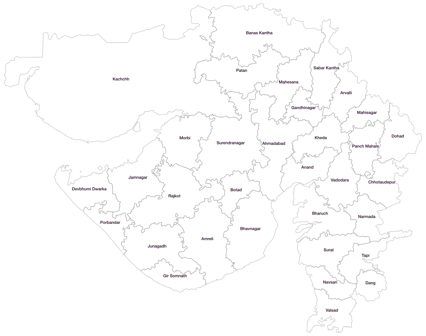
All 33 districts of Gujarat
- AhmadabadLGD 438
- AmreliLGD 439
- AnandLGD 440
- ArvalliLGD 672
- Banas KanthaLGD 441
- BharuchLGD 442
- BhavnagarLGD 443
- BotadLGD 676
- ChhotaudepurLGD 668
- DangLGD 444
- Devbhumi DwarkaLGD 674
- DohadLGD 445
- GandhinagarLGD 446
- Gir SomnathLGD 675
- JamnagarLGD 447
- JunagadhLGD 448
- KachchhLGD 449
- KhedaLGD 450
- MahesanaLGD 451
- MahisagarLGD 669
- MorbiLGD 673
- NarmadaLGD 452
- NavsariLGD 453
- Panch MahalsLGD 454
- PatanLGD 455
- PorbandarLGD 456
- RajkotLGD 457
- Sabar KanthaLGD 458
- SuratLGD 459
- SurendranagarLGD 460
- TapiLGD 641
- VadodaraLGD 461
- ValsadLGD 462
Map data for Gujarat
Paste two columns from Excel, district name and value, and the builder matches each row to its district by name, including older spellings and former names. Your data stays in your browser.
Gujarat is also available by PIN code (1,025 areas) and Lok Sabha constituency (26 seats).
Boundaries: india-geodata (LGD, Survey of India, DataMeet), CC BY 4.0. District counts follow the boundary release in use (version 2026.09); a district created after that release is not yet on the map. This state page is part of the geography catalogue.
District maps of other states and UTs
- Andaman & Nicobar Islands
- Andhra Pradesh
- Arunachal Pradesh
- Assam
- Bihar
- Chandigarh
- Chhattisgarh
- Dadra & Nagar Haveli and Daman & Diu
- Delhi
- Goa
- Haryana
- Himachal Pradesh
- Jammu & Kashmir
- Jharkhand
- Karnataka
- Kerala
- Ladakh
- Lakshadweep
- Madhya Pradesh
- Maharashtra
- Manipur
- Meghalaya
- Mizoram
- Nagaland
- Odisha
- Puducherry
- Punjab
- Rajasthan
- Sikkim
- Tamil Nadu
- Telangana
- Tripura
- Uttar Pradesh
- Uttarakhand
- West Bengal