District map
Karnataka district map
Karnataka has 31 districts in Maps by India Layer’s boundaries, each with its Local Government Directory (LGD) code. Colour them from your own spreadsheet and export a PNG or an editable SVG.
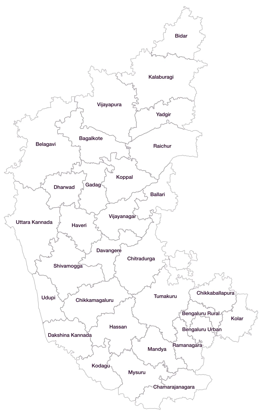
All 31 districts of Karnataka
- BagalkoteLGD 524
- BallariLGD 528
- BelagaviLGD 527
- Bengaluru RuralLGD 526
- Bengaluru UrbanLGD 525
- BidarLGD 529
- ChamarajanagaraLGD 531
- ChikkaballapuraLGD 630
- ChikkamagaluruLGD 532
- ChitradurgaLGD 533
- Dakshina KannadaLGD 534
- DavangereLGD 535
- DharwadLGD 536
- GadagLGD 537
- HassanLGD 539
- HaveriLGD 540
- KalaburagiLGD 538
- KodaguLGD 541
- KolarLGD 542
- KoppalLGD 543
- MandyaLGD 544
- MysuruLGD 545
- RaichurLGD 546
- RamanagaraLGD 631
- ShivamoggaLGD 547
- TumakuruLGD 548
- UdupiLGD 549
- Uttara KannadaLGD 550
- VijayanagarLGD 738
- VijayapuraLGD 530
- YadgirLGD 635
Map data for Karnataka
Paste two columns from Excel, district name and value, and the builder matches each row to its district by name, including older spellings and former names. Your data stays in your browser.
Karnataka is also available by PIN code (1,355 areas) and Lok Sabha constituency (28 seats).
Boundaries: india-geodata (LGD, Survey of India, DataMeet), CC BY 4.0. District counts follow the boundary release in use (version 2026.09); a district created after that release is not yet on the map. This state page is part of the geography catalogue.
District maps of other states and UTs
- Andaman & Nicobar Islands
- Andhra Pradesh
- Arunachal Pradesh
- Assam
- Bihar
- Chandigarh
- Chhattisgarh
- Dadra & Nagar Haveli and Daman & Diu
- Delhi
- Goa
- Gujarat
- Haryana
- Himachal Pradesh
- Jammu & Kashmir
- Jharkhand
- Kerala
- Ladakh
- Lakshadweep
- Madhya Pradesh
- Maharashtra
- Manipur
- Meghalaya
- Mizoram
- Nagaland
- Odisha
- Puducherry
- Punjab
- Rajasthan
- Sikkim
- Tamil Nadu
- Telangana
- Tripura
- Uttar Pradesh
- Uttarakhand
- West Bengal