District map
Assam district map
Assam has 35 districts in Maps by India Layer’s boundaries, each with its Local Government Directory (LGD) code. Colour them from your own spreadsheet and export a PNG or an editable SVG.
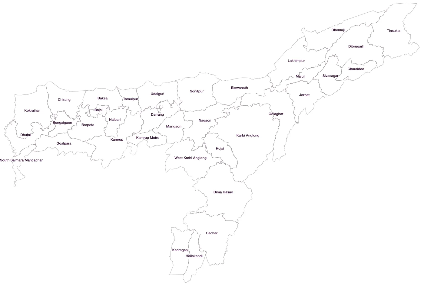
All 35 districts of Assam
- BajaliLGD 739
- BaksaLGD 616
- BarpetaLGD 280
- BiswanathLGD 705
- BongaigaonLGD 281
- CacharLGD 282
- CharaideoLGD 708
- ChirangLGD 612
- DarrangLGD 283
- DhemajiLGD 284
- DhubriLGD 285
- DibrugarhLGD 286
- Dima HasaoLGD 299
- GoalparaLGD 287
- GolaghatLGD 288
- HailakandiLGD 289
- HojaiLGD 709
- JorhatLGD 290
- KamrupLGD 291
- Kamrup MetroLGD 618
- Karbi AnglongLGD 292
- KarimganjLGD 293
- KokrajharLGD 294
- LakhimpurLGD 295
- MajuliLGD 706
- MarigaonLGD 296
- NagaonLGD 297
- NalbariLGD 298
- SivasagarLGD 300
- SonitpurLGD 301
- South Salmara MancacharLGD 707
- TamulpurLGD 756
- TinsukiaLGD 302
- UdalguriLGD 617
- West Karbi AnglongLGD 710
Map data for Assam
Paste two columns from Excel, district name and value, and the builder matches each row to its district by name, including older spellings and former names. Your data stays in your browser.
Assam is also available by PIN code (608 areas) and Lok Sabha constituency (14 seats).
Boundaries: india-geodata (LGD, Survey of India, DataMeet), CC BY 4.0. District counts follow the boundary release in use (version 2026.09); a district created after that release is not yet on the map. This state page is part of the geography catalogue.
District maps of other states and UTs
- Andaman & Nicobar Islands
- Andhra Pradesh
- Arunachal Pradesh
- Bihar
- Chandigarh
- Chhattisgarh
- Dadra & Nagar Haveli and Daman & Diu
- Delhi
- Goa
- Gujarat
- Haryana
- Himachal Pradesh
- Jammu & Kashmir
- Jharkhand
- Karnataka
- Kerala
- Ladakh
- Lakshadweep
- Madhya Pradesh
- Maharashtra
- Manipur
- Meghalaya
- Mizoram
- Nagaland
- Odisha
- Puducherry
- Punjab
- Rajasthan
- Sikkim
- Tamil Nadu
- Telangana
- Tripura
- Uttar Pradesh
- Uttarakhand
- West Bengal