District map
Bihar district map
Bihar has 38 districts in Maps by India Layer’s boundaries, each with its Local Government Directory (LGD) code. Colour them from your own spreadsheet and export a PNG or an editable SVG.
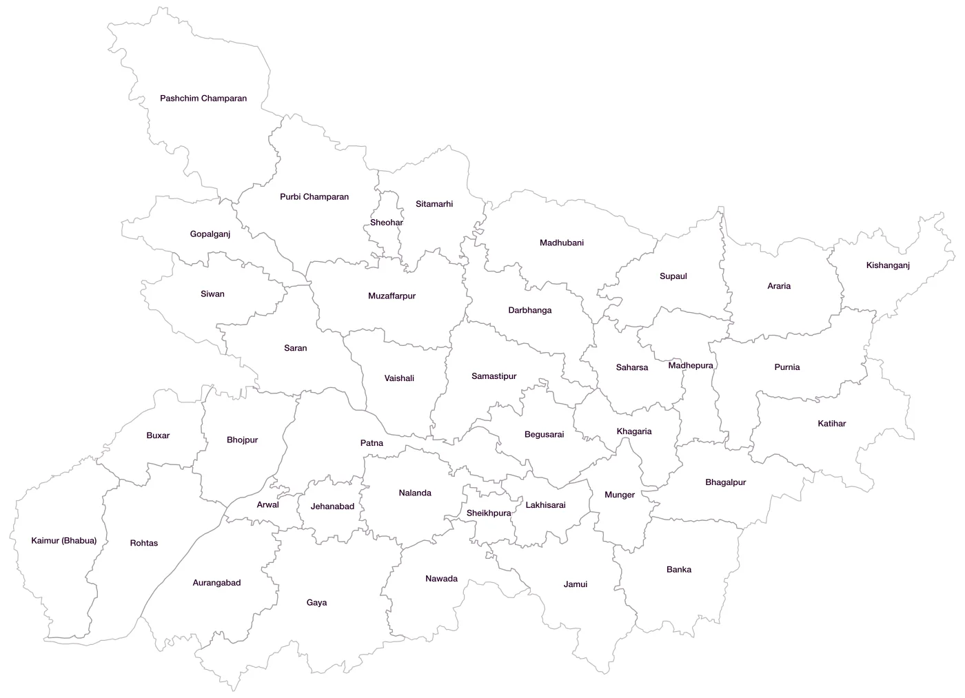
All 38 districts of Bihar
- ArariaLGD 188
- ArwalLGD 611
- AurangabadLGD 189
- BankaLGD 190
- BegusaraiLGD 191
- BhagalpurLGD 192
- BhojpurLGD 193
- BuxarLGD 194
- DarbhangaLGD 195
- GayaLGD 196
- GopalganjLGD 197
- JamuiLGD 198
- JehanabadLGD 199
- Kaimur (Bhabua)LGD 200
- KatiharLGD 201
- KhagariaLGD 202
- KishanganjLGD 203
- LakhisaraiLGD 204
- MadhepuraLGD 205
- MadhubaniLGD 206
- MungerLGD 207
- MuzaffarpurLGD 208
- NalandaLGD 209
- NawadaLGD 210
- Pashchim ChamparanLGD 211
- PatnaLGD 212
- Purbi ChamparanLGD 213
- PurniaLGD 214
- RohtasLGD 215
- SaharsaLGD 216
- SamastipurLGD 217
- SaranLGD 218
- SheikhpuraLGD 219
- SheoharLGD 220
- SitamarhiLGD 221
- SiwanLGD 222
- SupaulLGD 223
- VaishaliLGD 224
Map data for Bihar
Paste two columns from Excel, district name and value, and the builder matches each row to its district by name, including older spellings and former names. Your data stays in your browser.
Bihar is also available by PIN code (929 areas) and Lok Sabha constituency (40 seats).
Boundaries: india-geodata (LGD, Survey of India, DataMeet), CC BY 4.0. District counts follow the boundary release in use (version 2026.09); a district created after that release is not yet on the map. This state page is part of the geography catalogue.
District maps of other states and UTs
- Andaman & Nicobar Islands
- Andhra Pradesh
- Arunachal Pradesh
- Assam
- Chandigarh
- Chhattisgarh
- Dadra & Nagar Haveli and Daman & Diu
- Delhi
- Goa
- Gujarat
- Haryana
- Himachal Pradesh
- Jammu & Kashmir
- Jharkhand
- Karnataka
- Kerala
- Ladakh
- Lakshadweep
- Madhya Pradesh
- Maharashtra
- Manipur
- Meghalaya
- Mizoram
- Nagaland
- Odisha
- Puducherry
- Punjab
- Rajasthan
- Sikkim
- Tamil Nadu
- Telangana
- Tripura
- Uttar Pradesh
- Uttarakhand
- West Bengal